

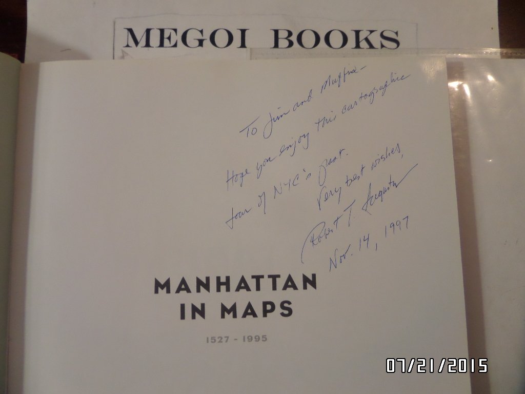
Manhattan in Maps: 1527-1995
Product details
| Management number | 232079593 | Release Date | 2026/06/18 | List Price | $20.62 | Model Number | 232079593 | ||
|---|---|---|---|---|---|---|---|---|---|
| Category | |||||||||
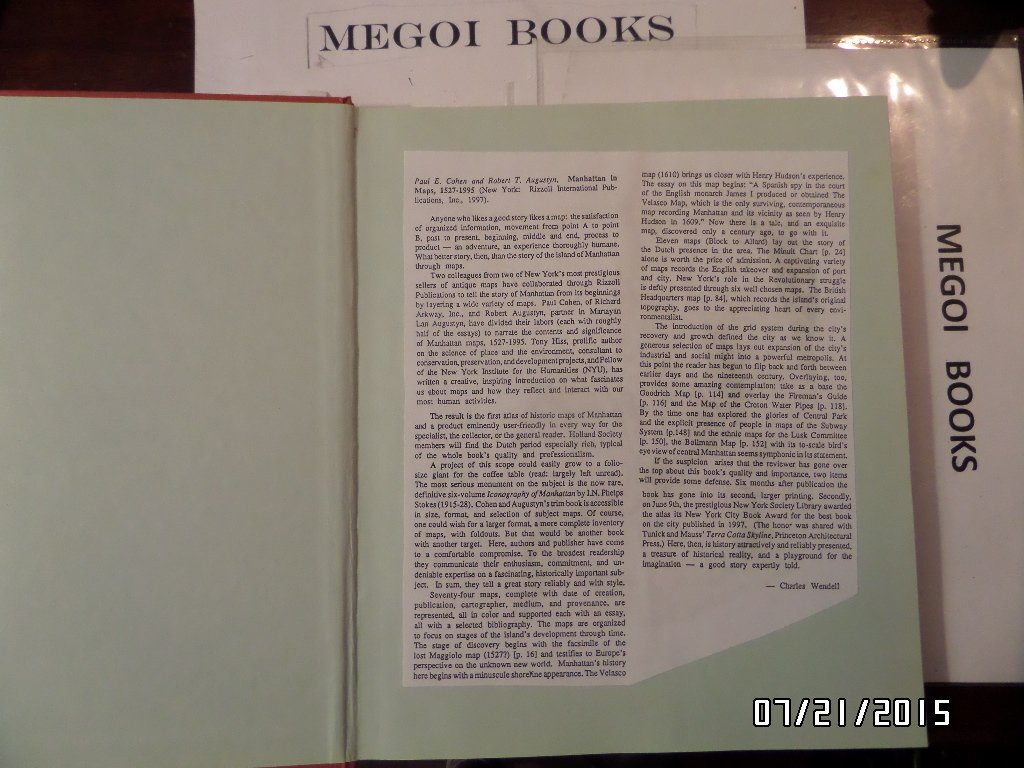
"...the city's first atlas of historical maps...destined to have a profound and positive influence on twenty-first-century New York."--from the foreword by Tony HissThis lavishly illustrated volume explores New York's urban and social history through rare and beautiful maps of the city produced during the past four hundred years and collected from archives and libraries throughout the world. From a crude woodblock engraving depicting Giovanni da Verrazano's first glimpse of New York Harbor in the sixteenth century to the latest satellite photograph of Manhattan, these important documents offer an unprecedented "avenue to New York's past," as the authors write in their preface-- a fascinating collective portrait of the evolution of America's oldest major city.Many of the 65 color plates reproduced here have never been published before, and each is accompanied by an engaging essay on the changing physical and social contours of New York as revealed in the map's details and provenance. Opening with a chapter on the discovery of New York Harbor as depicted in sixteenth-century Italian maps, the book explores the bustling Dutch trading outpost of New Amsterdam (the original name for New York), the city as a British colony in the seventeenth and eighteenth centuries, the rise of New York as a port city in the eighteenth century, the Revolutionary War period, and the development of the Manhattan grid, public squares, and parks in the nineteenth century. The city's myriad "worlds within a world" are shown in unusual maps of such diverse subjects as ethnic neighborhoods, midtown vice, and the subway system. Each entry cites the map's date of creation and publication, cartographer, medium, and the institution or private collection where the map is archived. A bibliography and complete index are also included, making this book an indispensable resource for all those interested in New York history, urban history, and antiquarian maps. Read more
| ISBN10 | 0847820521 |
|---|---|
| ISBN13 | 978-0847820528 |
| Edition | First Edition |
| Language | English |
| Publisher | Rizzoli |
| Dimensions | 9.59 x 0.86 x 10.93 inches |
| Item Weight | 2.4 pounds |
| Print length | 164 pages |
| Publication date | August 15, 2006 |


Bestseller ranking
Brow Brushes


Customers who viewed this product also viewed
Historic


Correction of product information
If you notice any omissions or errors in the product information on this page, please use the correction request form below.
Correction Request Form